Home / Architectural / Aerial 3D View
3D Aerial View Rendering for Architectural Projects
Aerial Architectural Visualizations for Planning, Presentation, and Marketing
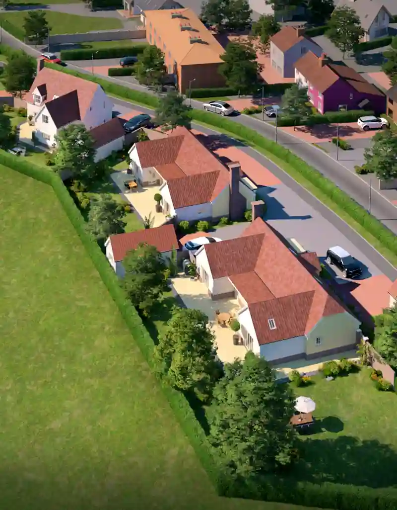
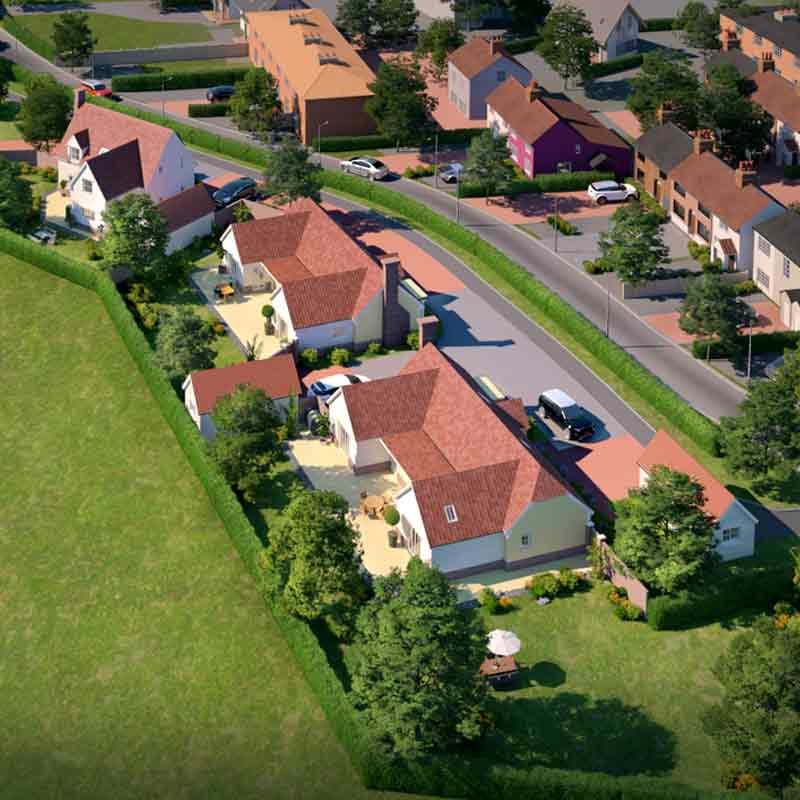
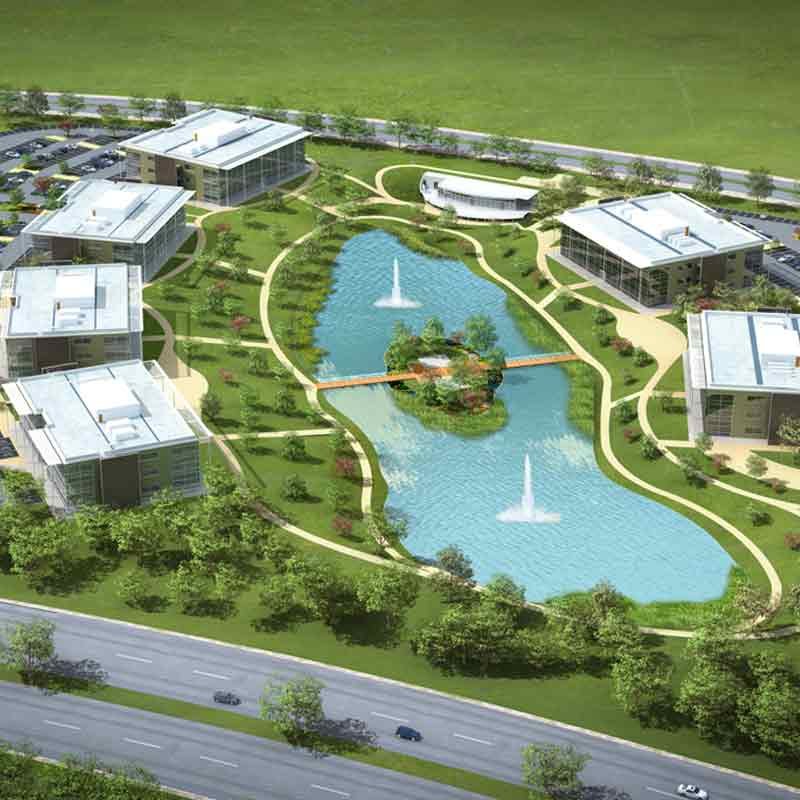
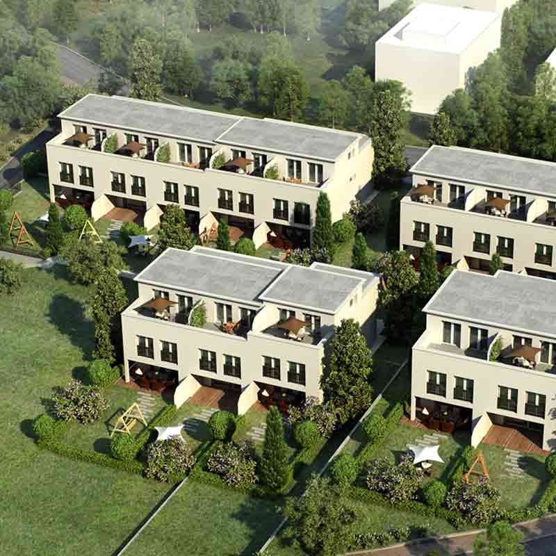
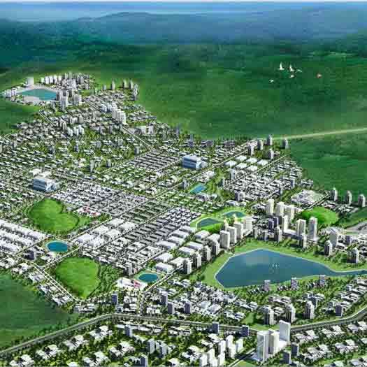
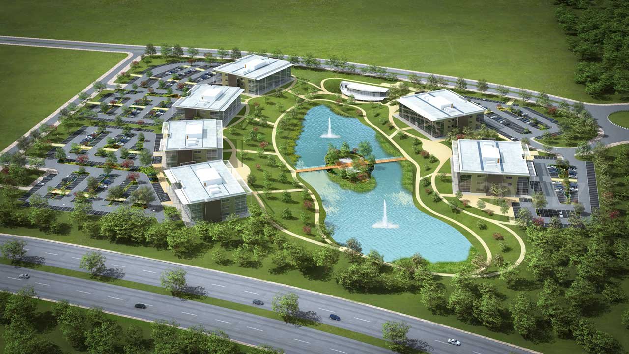
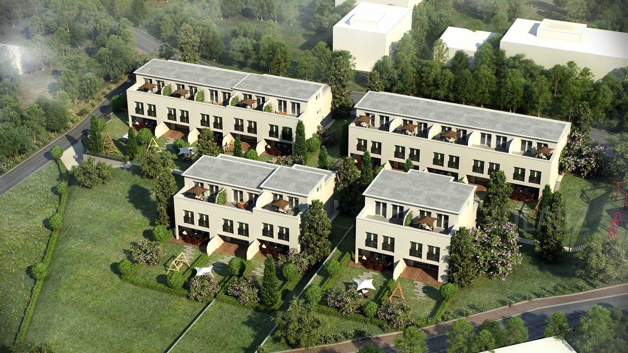
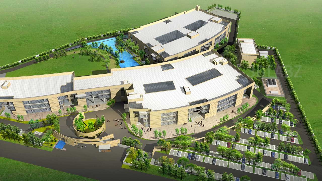
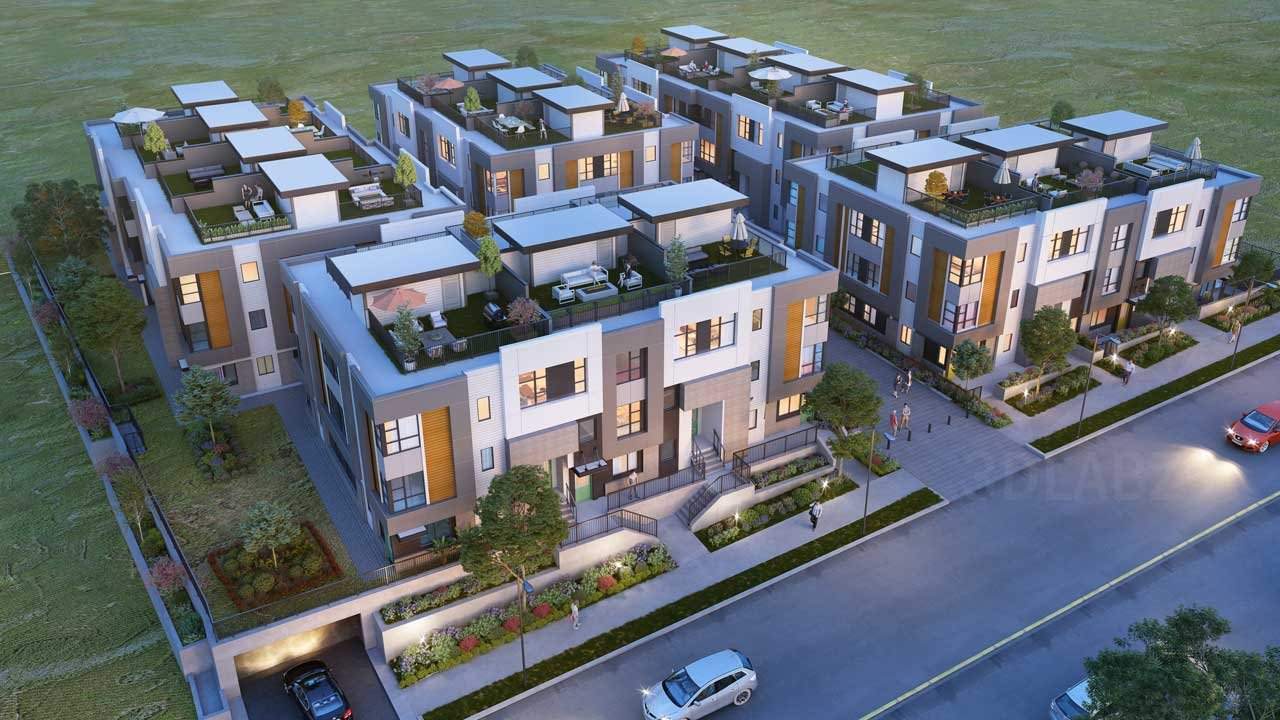
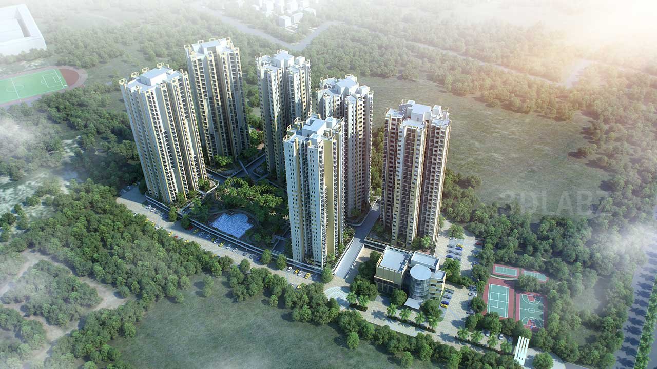
3D aerial renderings help architects and developers understand a project from above, clearly showing site layout, building relationships, and surrounding context. 3D aerial images are often used for planning reviews, presentations, and early-stage marketing.
OUR WORKREQUEST PRICE
SINCE 2005
Our Expertise in Architectural 3D Aerial View Rendering
In our experience, aerial views are often the point where a project finally starts to make sense for everyone involved. Floor plans and site layouts are useful, but they don’t always show how buildings relate to each other, how access works, or how the overall site comes together. That’s where 3D aerial rendering becomes genuinely helpful.
We’ve been creating architectural 3D visualisations for over 20 years, working with architects, planners, and developers on projects of very different scales. Some are compact residential layouts. Others are large mixed-use developments or townships where understanding the bigger picture really matters. The reality is, an aerial view isn’t about making a project look impressive from above — it’s about making the layout understandable.
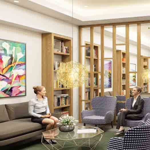
Beyond aerial views, we offer a range of architectural 3D rendering services to support projects at every stage. This includes exterior and 3D interior renderings, 3D cross-sections, and photomontage visuals for residential, commercial, and mixed-use developments, from small homes to large townships and specialised sectors such as hospitals, hotels, SEZs, and retail spaces. Our focus stays on clear, accurate visuals that place the design in context and communicate it effectively to the intended audience.
We’ve been creating architectural 3D visualisations for over 20 years, working with architects, planners, and developers on projects of very different scales. Some are compact residential layouts. Others are large mixed-use developments or townships where understanding the bigger picture really matters. The reality is, an aerial view isn’t about making a project look impressive from above — it’s about making the layout understandable.
Beyond aerial views, we offer a range of architectural 3D rendering services to support projects at every stage. This includes exterior and 3D interior renderings, 3D cross-sections, and photomontage visuals for residential, commercial, and mixed-use developments, from small homes to large townships and specialised sectors such as hospitals, hotels, SEZs, and retail spaces. Our focus stays on clear, accurate visuals that place the design in context and communicate it effectively to the intended audience.
Benefits of an Aerial 3D View Render
An aerial view helps people understand a project at a glance, especially when the site is large or spread out. Seeing everything from above makes it easier to grasp how buildings, roads, open spaces, and surroundings relate to each other without jumping between multiple drawings.A bird’s-eye view makes these relationships clearer and helps teams spot layout issues early.
Showreel – Architectural 3D Aerial View Rendering
This showreel presents selected 3D aerial and bird’s-eye view renderings of residential, commercial, and large-scale developments. The visuals highlight site layout, building relationships, access points, and surrounding context to clearly convey overall planning concepts from an overhead perspective.Watch 3D Renderings On
FEATURED WORK
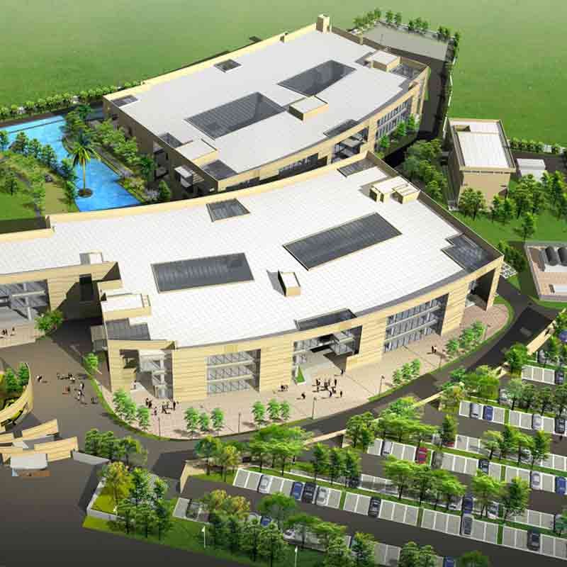
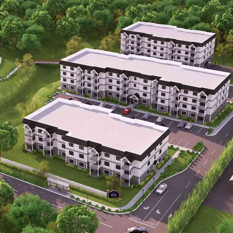
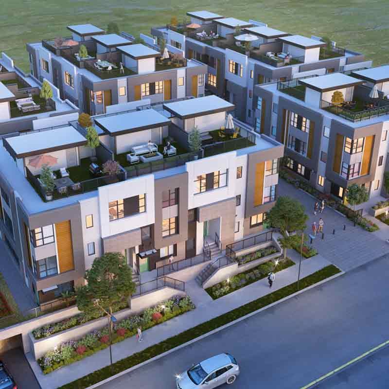
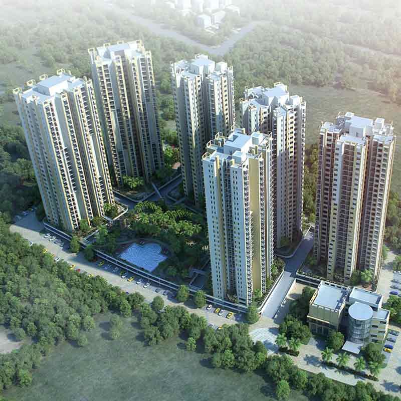
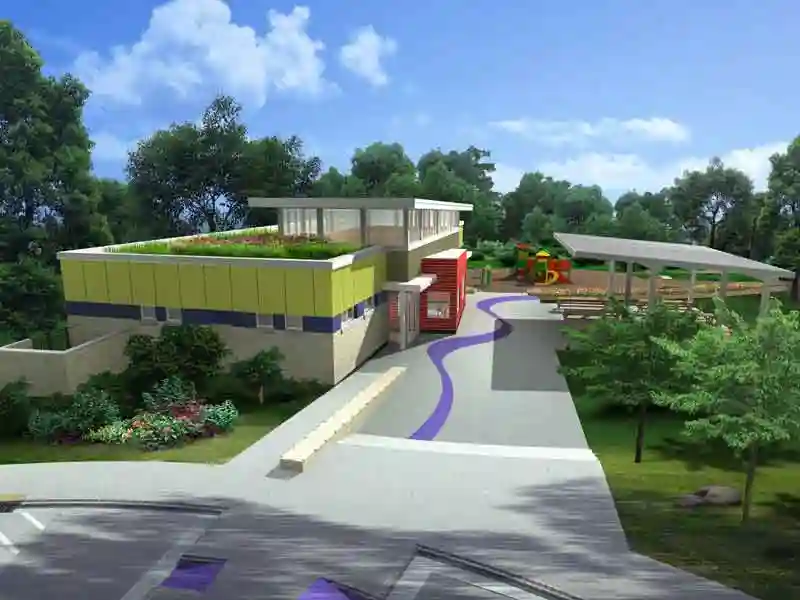
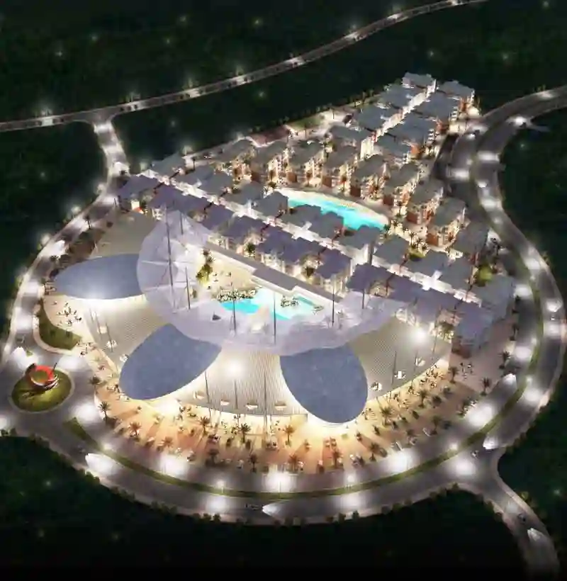
3D Aerial Rendering for Large-Scale Architectural Projects


3D Photomontage
Aerial 3D Rendering on Drone Photography
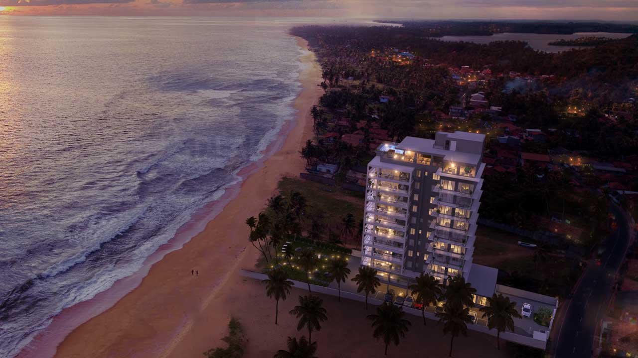
Drone-based aerial rendering allows us to place a proposed building directly into a real site photograph, providing a level of context that a purely computer-generated background simply cannot match. This process, known as 3D photomontage rendering, relies on more than just aligning the camera perspective. For the visual to be successful, the lighting intensity and shadow direction must be synchronised with the exact atmospheric conditions present in the drone image.
Scaling Realism: Photomontage Solutions for Every Project Size
Our 3D photomontage rendering scales to match any project size without compromising on technical rigour. We blend precision drone data with your design to ensure every build—from a private residential home to a 50-acre masterplan—interacts realistically with its unique environment.-
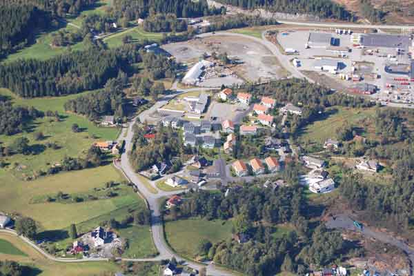
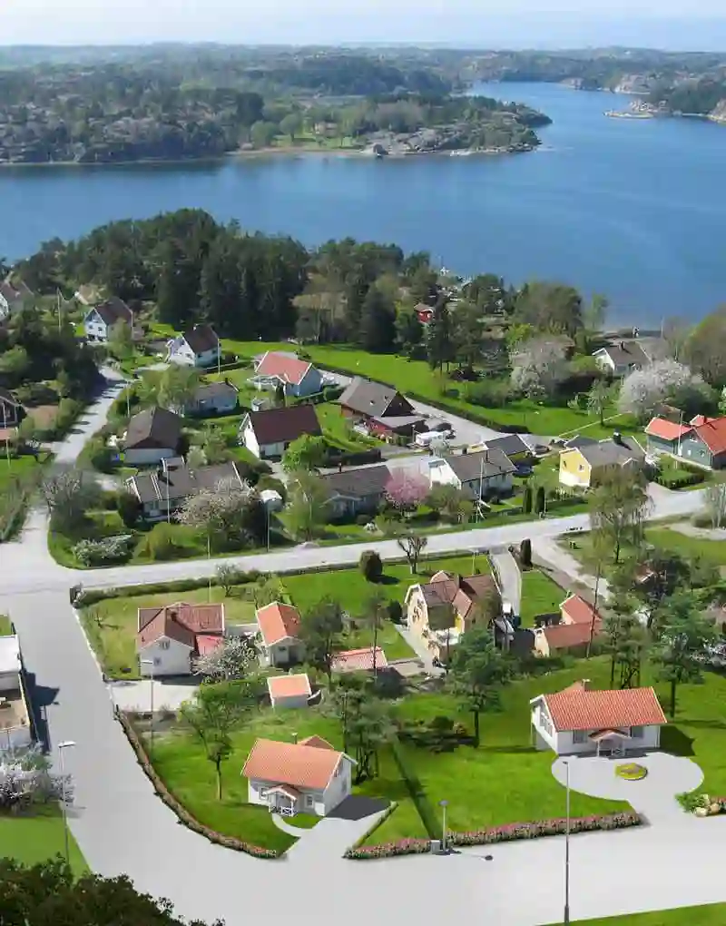
Residential Project - Olderdalen, Norway
-
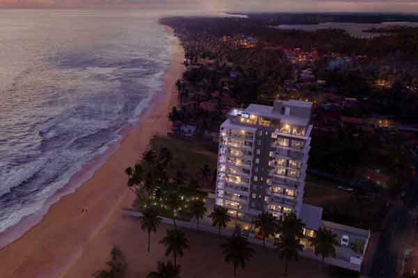
Luxury Apartment - Colombo, Sri Lanka
-
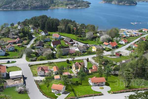
Villa Project - Östermalm, Stockholm, Sweden
-
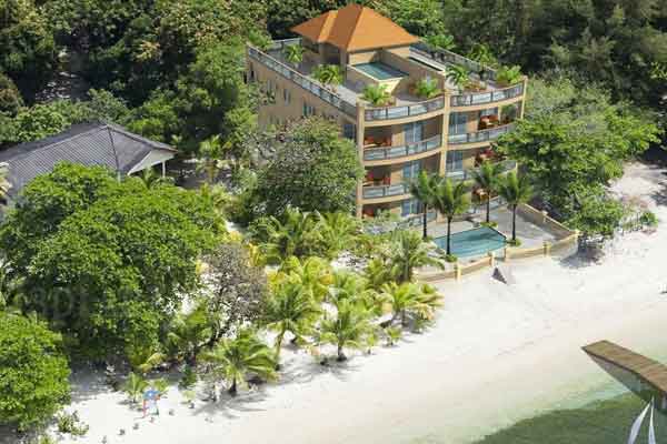
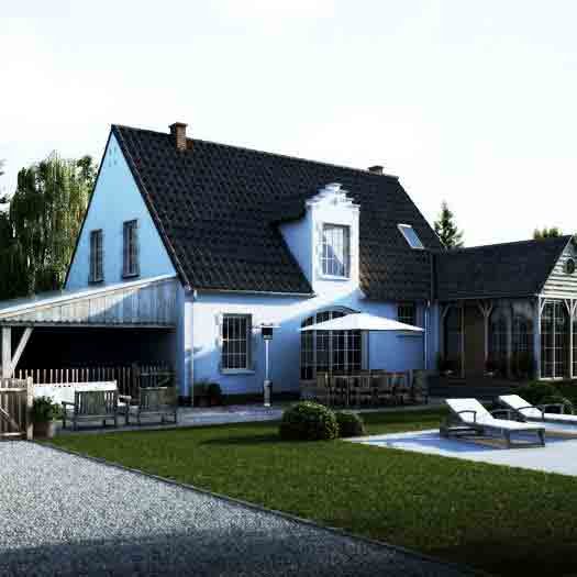
Beach Hotel - San Diego, California
Beyond the Overlay: The Science of Aerial 3D Photomontage
By utilising 3D photomontage rendering, we anchor your design into its actual physical context. Using the latest photogrammetry workflows, we create a "proxy mesh" of the surroundings so your building interacts with the real world.- Physical Interaction: Utilizing photogrammetry allows the new building to cast accurate shadows onto existing streets and neighboring structures.
- Planning Approval Proof: The level of accuracy of aerial 3D photomontage provides "proof of impact," helping architects demonstrate exactly how the tower affects sidewalk light and city skylines.
- Reciprocal Reflections: Existing cityscapes are reflected in your building's glass for total visual integration.
3D Aerial View Rendering for Architectural Presentations
Aerial Views for Understanding the Full Layout
Aerial 3D renderings make it easier to understand a project as a whole. By viewing the design from above, layouts, building placement, and open areas become clearer than they often are in ground-level views, especially for larger or more complex sites.AI-Integrated Aerial 3D Visualization: Beyond the Hype
AI can support architectural 3D rendering when it’s used carefully and in the right places. In aerial 3D visualization, we use AI tools mainly to assist with tasks like refining textures, improving vegetation detail, cleaning up large site data, and speeding up certain post-production steps. What AI does not replace is the core work — building the 3D model, setting up accurate lighting, matching shadows, and deciding viewpoints still rely on experience and judgement. At 3DLabz, AI serves as a support layer in our workflow, improving efficiency and visual clarity while maintaining full control over accuracy and design intent.Aerial 3D Rendering for Urban Planning: The "Digital Twin" Advantage
Urban planning is increasingly moving toward a Digital Twin model, where a 3D aerial isn't just a picture—it’s a data-rich environment. At 3DLabz, we go beyond basic massing studies by integrating GIS data and site-specific topography into our renders. This allows planners and architects to move past "gut feelings" and visually simulate how a new development will actually interact with street-level shadows, wind corridors, and the existing neighbourhood grain.When One View Says It All
Aerial 3D renderings show how everything connects, helping teams instantly understand the project.The team at 3DLabz is a pleasure to work with, always customer-focused and responsive. We look forward to working together again in the future.

Pamela Klassen
CEO, HomeLife Glenayre Realty Co. Ltd., Abbotsford, Canada
SEE ALL REVIEWS
Why aerial views help real estate projects move faster
Ground-level images are useful for showing the building itself, but they don’t always tell the full story. For most buyers, location matters just as much as architecture. People aren’t only buying a structure; they’re buying into the surroundings, the views, and how the place fits into everyday life.Aerial and photomontage renderings help make that clear. By placing a proposed project into its real environment, these visuals show how it sits within the skyline, what it looks out onto, and how close it is to key landmarks or amenities.
Why Choose 3DLabz for Aerial 3D View Rendering
We work with architects, planners, and developers to create aerial 3D views that clearly explain site layout, scale, and context.- Aerial visuals focused on layout, circulation, building relationships, and surrounding context.
- Experience across a wide range of projects , from individual sites to large-scale developments and townships.
- Collaborative workflow that allows review and refinements at key stages, before final delivery.
OUR WORKS
Selected Architectural 3D Rendering Projects


Frequently Asked Questions
-
How do you create a 3D aerial view? What files and information are required?
We generate 3D aerial views by modeling building structures, adding landscape details, and rendering from an overhead perspective using 3D software. We require design drawings like floor plans and elevations, material references, and landscape details.
-
How many iterations are involved in the feedback process for 3D rendering?
A maximum of three revision rounds is allowed for 3D rendering projects.
-
How long does it typically take to create a 3D aerial view?
The usual timeframe for completing our 3D modelling and rendering project is 7-10 days, including revision time. However, the turnaround may vary depending on the project's size and complexity.
-
Can you create 3D aerial renderings using the files from our SketchUp or Revit designs?
Yes, we can create 3D renders using your SketchUp or Revit files.
-
At what resolution is the final high-resolution image rendered for aerial views?
Typically, we deliver final images at 4000 pixels. If you require a higher resolution, please inform us in advance.
3D Aerial Rendering Price
The cost of 3D aerial rendering varies based on the scope and complexity of the project. Factors such as site size, level of detail, and surrounding context all influence the effort required. Projects that involve dense urban areas, large developments, or detailed environments typically require more time to model and refine. The number of aerial views needed also affects pricing, as some projects can be explained with a single image while others benefit from multiple angles.Understanding 3D Rendering Costs: Key Pricing Factors
Some of the key factors influencing the price include:- Project Complexity: The complexity of the design and the level of detail required will impact the cost. Complex and detailed scenes or buildings will generally cost more to render.
- Number of Views or Angles: It may impact the overall cost if you need multiple views or angles of the same scene.
- Image Resolution: Higher-resolution rendering often comes with a higher price tag. The cost may be higher if you need high-resolution images of more than 5000 pixels.
- Revisions: We offer three revisions as part of our initial pricing. Additional revisions beyond this will incur an extra fee.
LET'S DISCUSS
Request a Free Quote
For a project-specific estimate, you can share your requirements with our team


